

Cartographers – Alexandre Shirinin
Updated by Soares dos Reis / Valdemar Sendim
Path Tracer – Alexandre Reis
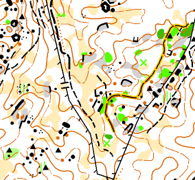
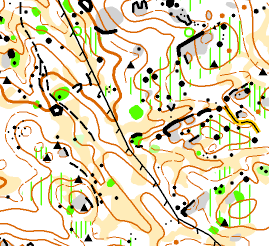
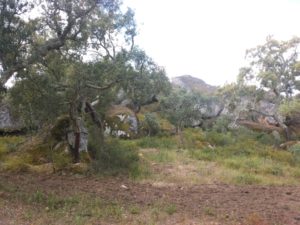
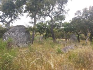
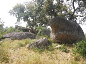
Terrain of forest in Alentejo, with rocky details. Little gap and easy run. Existence of some fences. Partially new. Map updated.
Distances
| Class | Length (m) | Climb (m) | Controls | Scale |
| M10 | 1.900 | 20 | 9 |
1:7.500
|
| W10 | 1.900 | 20 | 9 | |
| M12 | 2.800 | 30 | 13 | |
| W12 | 2.800 | 30 | 13 | |
| M14 | 3.400 | 50 | 15 |
1:10.000 |
| W14 | 2.700 | 45 | 12 | |
| M16 | 4.500 | 120 | 21 | |
| W16 | 3.500 | 90 | 14 | |
| M18 | 5.000 | 130 | 21 | |
| W18 | 4.200 | 115 | 18 | |
| M20 | 5.600 | 165 | 24 | |
| W20 | 4.800 | 130 | 18 | |
| M21A | 5.000 | 165 | 20 | |
| W21A | 3.700 | 125 | 16 | |
| MSE | 7.200 | 270 | 25 | |
| ME | 7.200 | 270 | 27 | |
| WE | 5.500 | 160 | 23 | |
| M21B | 3.200 | 90 | 16 | |
| W21B | 3.000 | 105 | 14 | |
| M35 | 5.500 | 150 | 23 | |
| W35 | 4.200 | 130 | 19 | |
| M40 | 5.200 | 160 | 20 | |
| W40 | 4.000 | 135 | 15 | |
| M45 | 4.900 | 155 | 20 | |
| W45 | 3.600 | 105 | 16 | |
| M50 | 4.600 | 135 | 17 | |
| W50 | 3.500 | 95 | 18 | |
| M55 | 4.000 | 130 | 18 | |
| W55 | 3.300 | 90 | 15 | |
| M60 | 3.800 | 110 | 17 | |
| W60 | 2.900 | 80 | 14 | |
| M65 | 3.200 | 100 | 15 |
1:7.500
|
| W65 | 2.800 | 90 | 14 | |
| M70 | 3.000 | 95 | 17 | |
| W70 | 2.600 | 85 | 11 | |
| M75 | 2.800 | 90 | 14 | |
| W75 | 2.000 | 70 | 10 | |
| M80 | 2.500 | 85 | 11 | |
| W80 | 2.000 | 70 | 10 | |
| M85 | 2.000 | 70 | 10 | |
| W85 | 2.000 | 70 | 10 | |
| Easy Short | 2.400 | 20 | 11 | |
| Easy long | 3.000 | 50 | 16 |
1:10.000
|
| Dificult Short | 2.700 | 45 | 14 | |
| Dificult Long | 4.600 | 125 | 18 |