


Map: Quarteira
Terrain: Dune terrain with some detail. Mostly open area with bushes and
some trees. The challenges posed to participants mainly require reading the
map and interpreting the terrain.
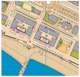
Map maker: Alexandre Reis
Course setter: Jorge Baltazar
Additional information:
• This stage is a PRE-O SPRINT, a timing system will be used. The use of SPORTident is mandatory.
• The PreO Sprint is limited to 150 participants.
• Control observation points are numbered sequentially along the route.
• To define the route to be taken, traffic cones will be placed in the areas marked on the map as closed crossings.
• 100% paved route.
• The organization does not provide helpers for participants using manual wheelchairs.
• There will be supply (water) at the end of the route.
• Complaints
– Location – Secretariat
– Timeout
▪ Technical problems – 15 minutes after finishing the route
▪ Classification errors – 15 minutes after fixing the provisional results
• A challenge A is resolved by answering “A” (Alpha), if the beacon is correctly positioned on the ground, in the center of the control circle on the map) or “Z” (zero), if the beacon is poorly positioned.
• The competition is governed by the IOF specifications and guidelines for elite TrailO PreO Sprint competitions and the FPO Trail-O competition regulations.
• In the Map Example:
– The low fences represented are dune palisades, which are
sometimes a slightly lower than the norm. In some places, for
readability reasons, the the oblique line was omitted.
– Special objects “O” are street lamps

1. The profile
PreO Sprint combines precision with high-speed decision making. It tests the athletes’ ability to read and interpret the map in complex terrain and make accurate decisions quickly. The total distance of the PreO Sprint course is to be kept as short as possible and it should only be possible for the best competitors to solve all problems correctly within the maximal allowed time.
A terrain that cannot provide this challenge is not appropriate for the PreO Sprint. Therefore, urban areas and parks that are suitable for TempOcompetitions might not be appropriate to use for a PreO Sprint.
2. The course
Courses shall have a minimum of 20 controls. There should be only A/Z tasks that can be solved in free order. Exactly one flag is placed in the terrain for each task, either at the position at the centre of the control circle (answer A) or at least 4 m (8 m for controls on large area and long line features or more than 50 m from the viewing point) away from the correct location (answer Z)
in line with IOF Guidelines for Zero tasks.
The maximal allowed time shall be 30 minutes or less (for the Open class); it is calculated as 1 minute per 30 m plus 1 minute per control. The total course distance (i.e. from start to finish and passing all decision points) must not exceed 15 m per control. Therefore, a typical PreO Sprint course would have 25 controls along a trail of 150 m length. However, if required, the course can
be split into two or three sections with a timed-out section in-between.
Separate maps to be handed out at the beginning of each section. The total distance including timed-out sections should be kept below 1 km.
The course should be on a flat track or area, ideally with a hard smooth surface, with a minimal width of 2.5m to permit wheelchairs passing. Timed out sections should be used to allow wheelchair users to navi-gate through non-flat sections of the course and to connect different parts of the area with interesting fea-tures with minimal competition distance.
Visibility of the area should be good to limit clustering of competitors at viewing points. While flags should be positioned so that they can be viewed from different positions along the track, viewing points should be marked in the terrain in numerical order along the path to indicate a position from where the competitor has very clear visibility of a particular control flag –additional flags can be visible from these points. Viewing points should clearly indicate the control number(s). To avoid congestion, each control should have its own viewing point and the minimum distance between viewing points should be 3 m. For fairness to competitors with limited mobility, it is recommended to place the viewing point so that the task can be solved from this position and no significant advantage can be gained by moving beyond the next decision point on the track.
3. Classification
Classification by total points (one point for each correctly solved control) minus a penalty of 1 point for each 1 min or fraction used past the maximum allowed time. Total time used on the course (minus timed-out sections) will be used as a tiebreaker.
A handicap system to adjust time used based on ground conditions and for manual wheelchair users who cannot use the map while moving will improve direct comparison between all competitors. As a guideline, for wheelchair users multiply total time by 0.8, and other competitors with P class eligibility, multiply total time by 0.9. If handicaps are used, the maximum allowed
course time for P class competitors should be adjusted accordingly, so that the maximum time after adjustment is the same for all competitors. For example, if the multiplier is 0.8 and the maximum time for the Open class is 28 minutes, the maximum time for the P class should be 35 minutes. The penalty of 1 point per minute (or part of a minute) over maximum time
applies for all classes and is not adjusted by any handicap factors used.
More info at: IOF website
Programme
13:00 Pre-O Event Center opens
13:30 Pre-O starts
17:30 Pre-O Prize-giving Ceremony