
Map Information
- Map – Mira Norte
- Mapping – Rafael Miguel (www.o-solutions.pt), June to December 2025
- Contour interval – 2,5 metres
- Symbols and Mapping Standards – the map was drawn according to the International Specification for Orienteering Maps 2017-2 issued by the International Orienteering Federation (IOF)


Terrain
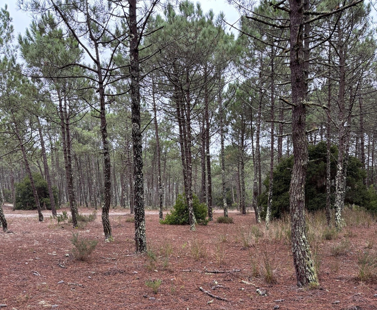
- Typical sand dune terrain. Forest of maritime pine (Pinus pinaster). The most common vegetation in the area is acacia (Acacia), also known as mimosa. In general, this type of vegetation is runnable. Brambles (Rubus ulmifolius) are rare in this map. There are some areas with gorse (Ulex jussiaei) and sand heath (Corema album).
- Vegetation varies considerably across the 25 km² of the Mira Norte map. Some areas are more semi-open, with smaller pine trees, while others feature mature forest with large pines. There are also places where dense vegetation was cleared a few years ago — in some of these, particularly on hilltops, acacias have already grown back significantly.


Specific Mapping Features
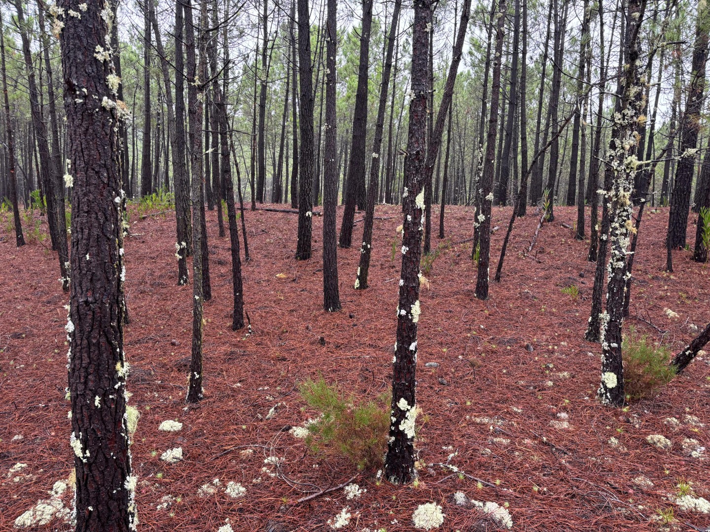
There are several clearly distinguishable vegetation clumps. In these cases, symbol 418 — Prominent bush or tree — has been used.
If a clump is not easily identifiable, or if its size exceeds the area covered by symbol 418, the vegetation is drawn to scale using the most appropriate shade of green.
In the photo below, two clumps marked with symbol 418 can be seen (one in the background on the left, the other on the right).
The “special tree” symbol (417 – Prominent large tree) was used for isolated trees (pines) or trees of different species. The 418 – Prominent bush or tree symbol was never used to represent trees, only distinct vegetation clumps.
The “special vegetation feature” symbol (419 – Prominent vegetation feature) was rarely used on this map – fallen trees or trunks are not mapped. This symbol was applied only to large fallen trees (rare) or to small wooden structures.
The water-related symbols (313 – Prominent water feature and 311 – Well, fountain or water tank) were not used in the competition area.
- The “black X” symbol (531 – Prominent man-made feature – X) was used in two specific situations:
For small concrete structures of approximately 1 × 1 × 1 metre; - In two parts of the map, a power line overlaps a path. The mapper chose to draw only the path and omit the power line symbol. The poles of these lines are marked with symbol 531.
The “black O” symbol (530 – Prominent man-made feature – ring) was used to represent small circular fences, roughly 4–6 metres in diameter.
In general, water channels (306 – Minor/seasonal water channel and 305 – Small crossable watercourse) are dry. They are usually much deeper than the gullies (symbol 108 – Small erosion gully).
Old Maps
Mira Norte

Dunas de Vagos (POM 2015)
")
Dunas de Vagos (Update 2023, after vegetation cleanup)
")